
Hi there,
This is to try and clarify the conversation that we had yesterday.
The initial SMART Vineyard scheme was planned by Vinewatch. It was planned as a bid for government money and, while it was a seriously thought out bid, detailed accuracy was not needed at that stage; merely quantities for budgeting purposes.
While we haven’t got the final go ahead yet, we do need to plan the next stage.
The site is currently a ‘live’ wheat field. The farmer needs to get in there to spray and harvest and it will need ground preparation before the vines are planted next year.
What is unique about the project is that it is going to collect data from sensors the site for a year before the vines are actually planted with vines, which is next year, and for that to happen the sensors need to be installed ASAP. They should have been installed weeks ago but politics has prevented that.
So, the idea was:
-
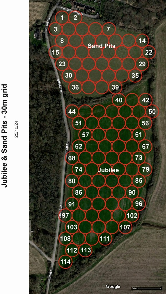
to get a detailed map of the proposed vineyard rows.
-
to match the schematic diagram used to submit the original project bid to the vine row map so that sensor positions coincide with vine rows.
-
generate a spreadsheet consisting of three columns: the sensor number (1-114), its Longitude and its Latitude (to RTK accuracy).
-
use a handheld RTK GPS device to establish where to position the sensors.
-
drill a hole in each sensor position and insert a sleeve in each hole with a removable cap on the top. The top of each sleeve is to be flush with the ground to allow farming equipment to pass over the top.
-
number 114 vine trellis posts so that they are visually recognisable with numbers 001 – 114
-
remove the sleeve cap from each sleeve insert each numbered post into its appropriate sleeve
-
attach a Ladybird to each numbered trellis post
We are at the start of the process but we are significantly behind schedule because we should have been gathering data for at least the last two months. On the other hand, we still have no formal order to proceed. We do however expect to get the order and we need to be prepared to spring into action the second it arrives!
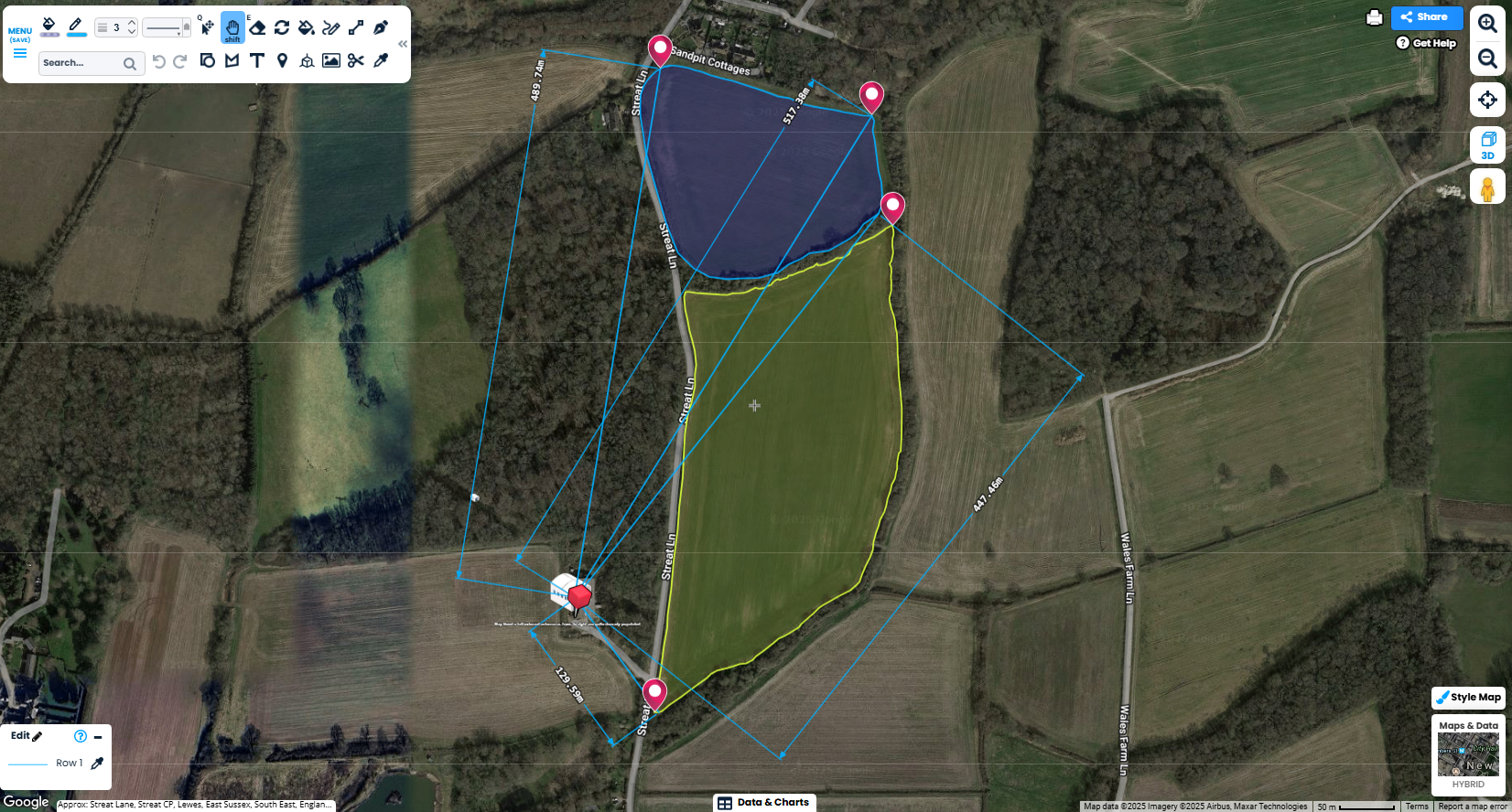
In spite of pressuring Plumpton College to provide us with the detailed map mentioned in point 1. above, while we have received the map itself, they have not yet provided the coordinates needed for us to be confident about the precise placing of the rows. We have therefore taken an executive decision to go ahead and generate the spreadsheet needed (point 3. above) without matching to the vine rows.
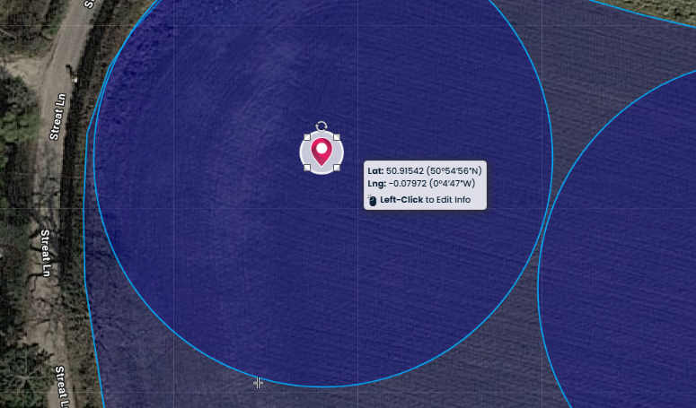
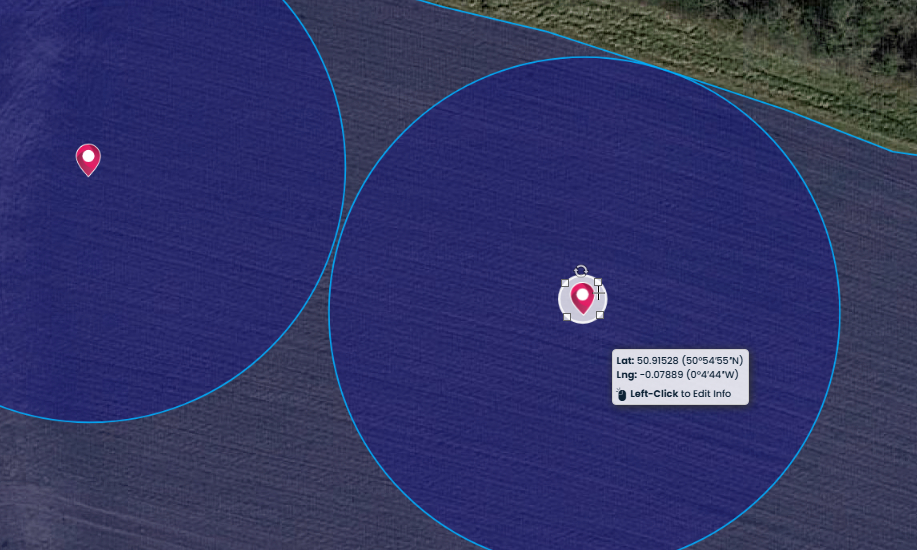
What we need is to use the schematic circles showing the grid of Ladybirds to generate the Longitude and Latitude of the centre of each circle and get that into a spreadsheet and I’m hoping that you might be able to do that Bill? We are resigned to having to move some of the sensor positions once the vines have been planted and the trellising installed, in a year’s time, but the thinking is that the distances that they will need to move, if any, are likely to be so small that they won’t invalidate the data.
I have attached the schematic showing the sensor positions as prepared for the bid. If I get more info I will let you have it. The only other information I currently have that is relevant is that the spacing between the rows is going to be 2.3m but that’s not a lot of help until we know the compass orientation!
I have also knocked up a spreadsheet showing what I think we need which is very simple and all that should be needed. If you are able to either generate a map or populate the spreadsheet, then that will get us off the ground.
All the best,
Seb
Sebastian Holmes
Operations Manager
Vinewatch Ltd
t: 0345 544 3736
m: 07770 501080
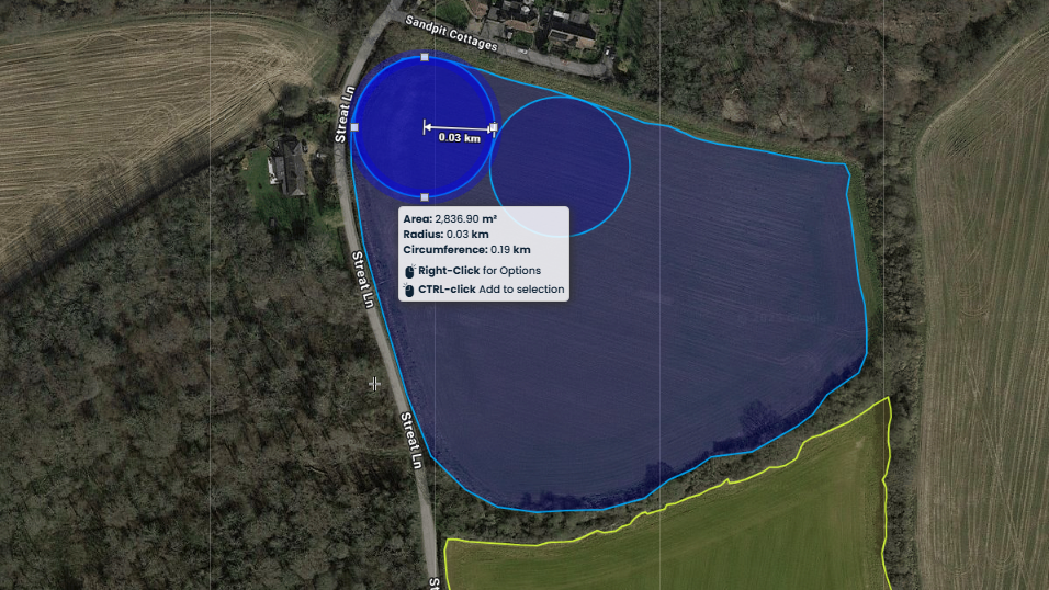
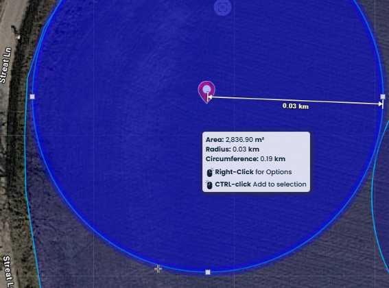
The circles will need to have a 30metre radius and this equates to a circle with an area of approximately 2827.45 square metres using the formula A = πr2 which is about 0.03 kilometers.
|
Plumpton SMART Vineyard |
|
|
|
|
|
Sensor Post Positions |
|
|
|
|
|
|
|
|
|
|
|
Post Number |
Longitude |
Latitude |
Ladybird Scanned Serial No |
Ladybird Scanned Serial No |
|
001 |
50.9154200 |
-0.0797200 |
p30g9426602o040010 |
|
|
002 |
50.9152800 |
-0.0788900 |
|
|
|
003 |
50.9130700 |
-0.0786000 |
|
|
|
004 |
50.9130700 |
-0.0786000 |
|
|
|
005 |
50.9130700 |
-0.0786000 |
|
|
|
006 |
50.9130700 |
-0.0786000 |
|
|
|
007 |
50.9130700 |
-0.0786000 |
|
|
|
008 |
50.9130700 |
-0.0786000 |
|
|
|
009 |
50.9130700 |
-0.0786000 |
|
|
|
010 |
50.9130700 |
-0.0786000 |
|
|
|
011 |
50.9130700 |
-0.0786000 |
|
|
|
012 |
50.9130700 |
-0.0786000 |
|
|
|
013 |
50.9130700 |
-0.0786000 |
|
|
|
014 |
50.9130700 |
-0.0786000 |
|
|